The Centre of Geospatial Technologies is a pioneering company specializing in geodetic surveying, aerial photography, mapping, and three-dimensional modeling of spatial data utilizing state-of-the-art technologies.
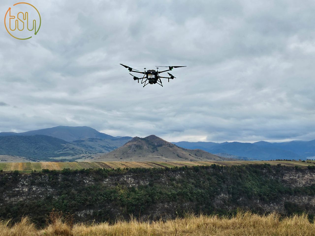
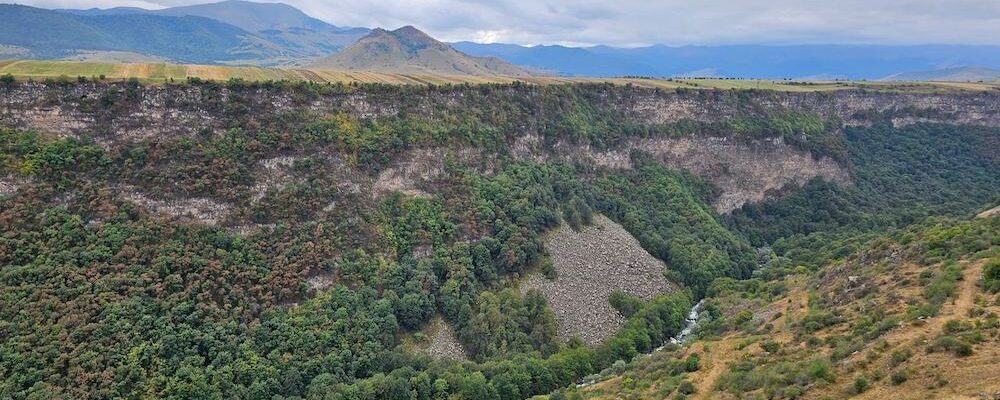
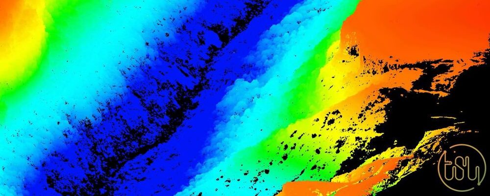
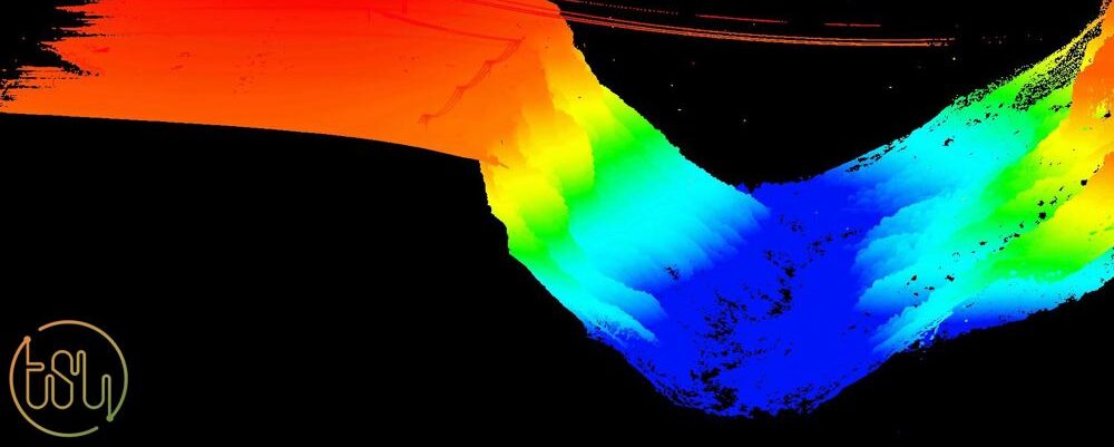
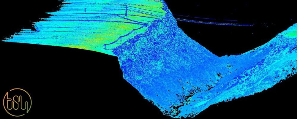
The Center of Geospatial Technologies, known for its commitment to innovation, recently conducted laser scanning of the Dzoraget canyon.
The cloud points obtained from this research, along with the development of a high-precision Digital Elevation Model and the creation of orthophotos, serve as compelling evidence of the remarkable capabilities of Alpha Uni 20.
The utilization of the AU 20 and its advanced equipment for canyon research significantly enhances data collection efficiency. Unlike traditional methods, it empowers precise mining in challenging and remote locations in a shorter time span.