The Centre of Geospatial Technologies is a pioneering company specializing in geodetic surveying, aerial photography, mapping, and three-dimensional modeling of spatial data utilizing state-of-the-art technologies.

Long-awaited news: The Center of Geospatial Technologies was equipped with an AlphaUni 20 laser scanner
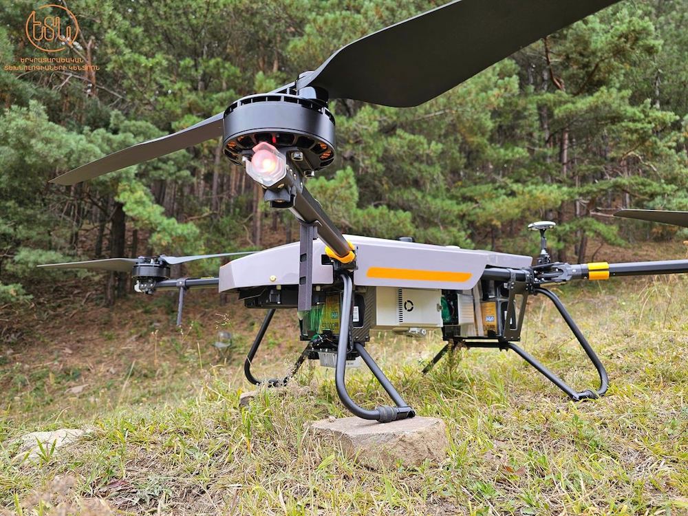
We are pleased to announce that our company has taken a new step towards advanced data acquisition technologies and has been equipped with a state-of-the-art AlphaUni 20 laser scanner, management and maintenance software and technical means.
This system is unique in terms of its production and functional significance, and the Republic of Armenia is the first CIS country in which it is represented.
With its remarkable capabilities, AlphaUni 20 promises to revolutionize the methods of spatial data collection and analysis in Armenia.
The Alpha Uni 20 is known for its exceptional accuracy and provides detailed and reliable data for a variety of projects, from topographic mapping to infrastructure assessment. It enables excellent data collection in various conditions, be it forestry, urban planning or archaeological research, becoming an indispensable tool for research.
The Center of Geospatial Technologies strives to push the boundaries and this investment once again underscores our unwavering commitment to staying at the forefront of technology and innovation.
Follow us and we will share in more detail the possibilities of using Alpha Uni 20 in the near future.